Use your plum bob to make sure your stick is vertical. Note: This activity is written for people in the southern hemisphere. Northern hemisphere mathematicians can still do this activity, but they will need to swap north and south. Use a compass to find South. If you’re using a magnetic compass, you may need to adjust the angle due to magnetic declination. This activity works best on only two days a year – the spring equinox (which falls around 23 September), and the Autumnal equinox (which falls around 20 March). However, it will work quite well for a week or two around those dates. For this activity to work, you have to set it up before 12.00 pm (noon) and the day must be sunny. Measure the length of the shadow. Divide the height of the stick by 10. Draw the stick and the shadow to scale. The diagonal of your triangle is in line with the equator. This activity measures the angle between the ground and the Sun. This angle changes throughout the day, with the Sun at the horizon at dawn and dusk, and high in the sky at noon. The measurement also changes throughout the year – in summer, the southern half of the world is tilted towards the Sun. In winter, the south pole is tilted away from the Sun. There are only two days a year where the Earth is not tilted with one end closer to the Sun. These two days are called the equinoxes, and they occur in September and March, when the seasons are changing. On the equinox, the Sun is sitting directly above the equator, which makes calculating latitudes a lot easier. After the equinox, the Earth tilts, and the Sun no longer sits directly above the equator – in Summer, the Sun is directly above a point somewhere in the southern tropics. You can still calculate your latitude when it is not the equinox, but the calculation is more complicated. People have known that the Earth was round for thousands of years, and they have used this fact to calculate latitude. Using the Sun to calculate latitude is quite difficult, because the Sun moves around throughout the day and the year. However, the stars are a lot more predictable, and one star in particular is very useful. Polaris, the North Star, sits directly above the North Pole. If you can measure the angle to Polaris, you can work out your latitude. Unfortunately, you can only see Polaris if you are in the northern hemisphere. Latitude only tells you how far north or south you are. In order to know exactly where you are on the Earth, you also need to know how far east or west you are. This measurement, called longitude, is just as important for navigating as latitude, but is much more difficult to measure. Captain Cook had an experimental clock on his second and third journeys that he used to calculate longitude. If you’re after more maths activities for kids, subscribe to Double Helix magazine! Categories: By submitting this form, you give CSIRO permission to publish your comments on our websites. Please make sure the comments are your own. For more information please see our terms and conditions. Sign up to our Double Helix newsletter Stay in touch with new updates by signing up to our free newsletter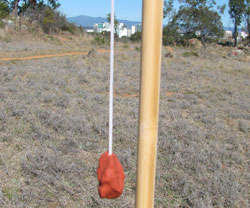 Safety: Ask an adult for permission before heading outdoors. Before you go, check the weather forecast and dress for the conditions. Protect yourself from the sun by wearing a hat, shirt, sunglasses and sunscreen.
You will need
What to do
Outside
Inside
What’s happening?
Real-life maths
If you’re after more science activities for kids, subscribe to
Double Helix magazine!
Similar posts
Newsletter
Advertisement
Blog
Where on Earth am I?
By
,Why choose the Double Helix magazine for your students?

Perfect for ages 8 – 14
Developed by experienced editors
Engaging and motivating
*84% of readers are more interested in science
Engaging students voice
Leave a Reply